
Certified Aerial Operations
Deploying FAA-licensed thermal imaging and high-resolution optical sensors across North Alabama. We deliver rapid-dispatch search capabilities and exact structural telemetry.
Targeted Aerial Solutions
Engineered for rapid response and analytical precision. We translate raw flight data into actionable thermal maps, structural reports, and high-impact media.
Thermal Recovery
Precision Mapping
HDR Real Estate
Rapid-dispatch grid searches utilizing radiometric thermal sensors to locate missing persons and lost pets when ground visibility is compromised.
High-resolution orthomosaic mapping and structural inspections. We generate detailed telemetry to identify anomalies, water leaks, and roof damage.
Sharp, high-contrast aerial photography capturing striking architectural angles. Engineered to accelerate property listings and commercial sales.
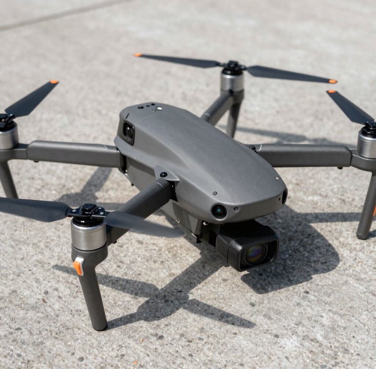
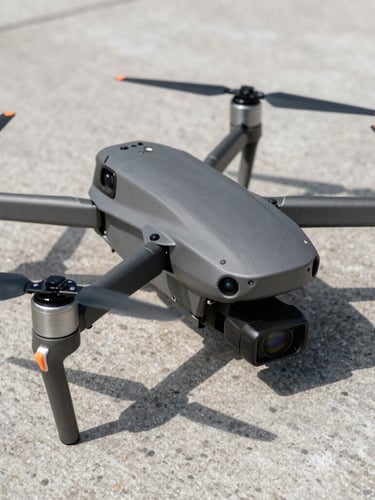
Enterprise Grade Sensors
We operate specialized industrial airframes equipped with dual-optical and radiometric thermal payloads to guarantee data accuracy in any environment.
Thermal Sensor
Optical Payload
Compliance
FLIR Boson radiometric core with 640x512 resolution. Captures exact temperature differentials for search operations and structural heat-loss mapping.
1-inch CMOS sensor delivering 20MP stills and 4K video at 60fps. Calibrated mechanical shutter eliminates rolling distortion during orthomosaic mapping.
FAA Part 107 certified operations with active airspace authorizations. Fully insured up to five million dollars for commercial utility and municipal search missions.
Initiate Aerial Dispatch
Contact our Huntsville-based flight desk today for immediate emergency search coordination or to schedule a high-resolution commercial property inspection.